Continental Divide: Wyoming

Continental Divide
The Continental Divide enters the great rectangular state of Wyoming at its northwestern corner, in Yellowstone National Park. From there it heads south with a bit of an easterly lean, missing the Teton Range, but forming the crest of the Wind River Range in the Bridger-Teton National Forest, before dropping through the historic migratory route known as South Pass. It then splits in two at the Great Divide Basin, the largest endorheic region on the Divide, where water drains not away, but inwards. The Divide unites again just before plunging into the heights of Colorado.
Continental Divide
The Continental Divide meanders around in the southwest corner of Yellowstone National Park, steering clear of Old Faithful, which is on the east side of the Divide.
Continental Divide
Most of the other water-based attractions in the park also drain into the Atlantic via tributaries to the Missouri.
Continental Divide
One exception is Isa Lake, which sits directly on the Divide, and is an unusual body of water. Some have called it the only natural lake in the world that drains into two oceans.
Continental Divide
Isa Lake is located at Craig Pass, where the road crosses the Continental Divide in the park for the first of three times.
Continental Divide
Historically, the lake (a pond really) grows with spring runoff and spills over its shores down both sides of the Divide.
Continental Divide
The west end flows into Spring Creek, which drains into the Firehole River, and thus into the Atlantic Ocean, via the Missouri and Mississippi Rivers.
Continental Divide
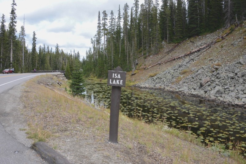
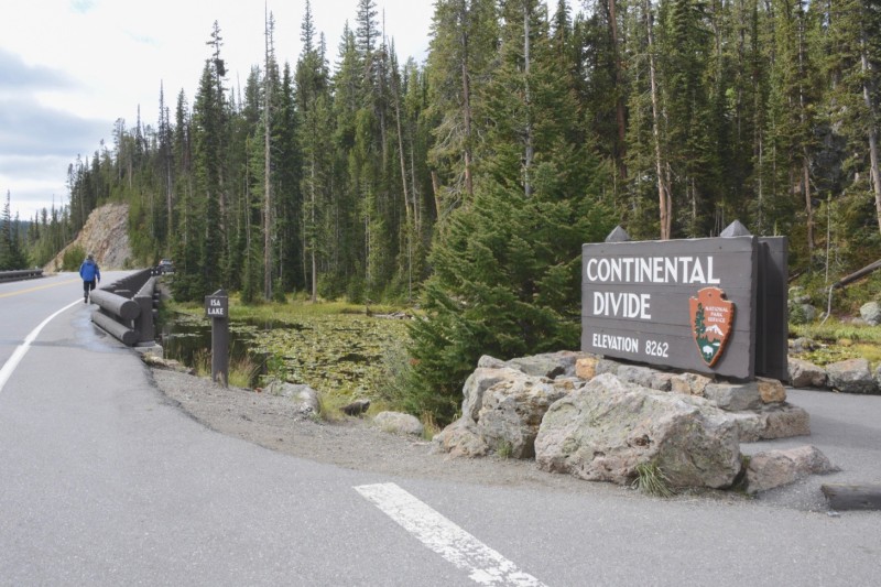
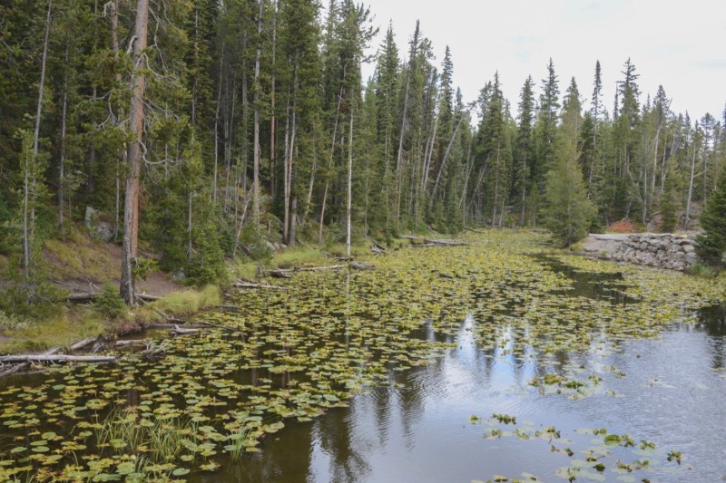
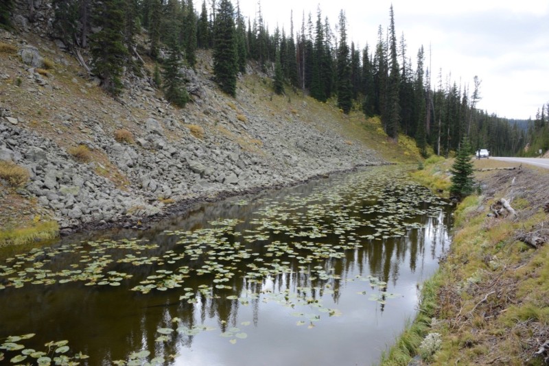
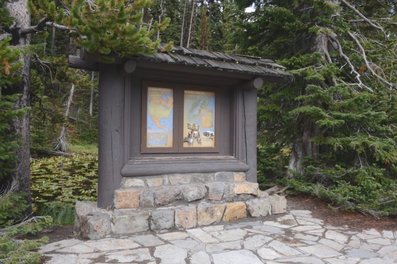
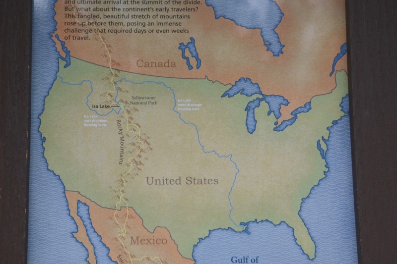
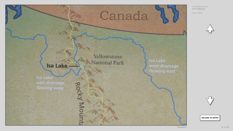
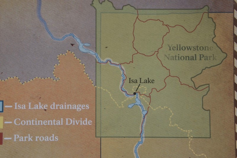
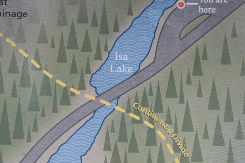
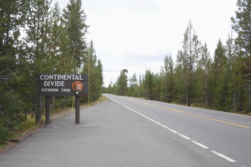
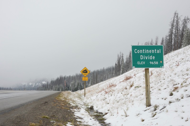
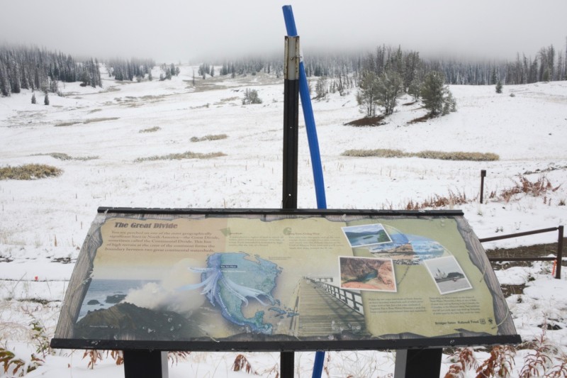
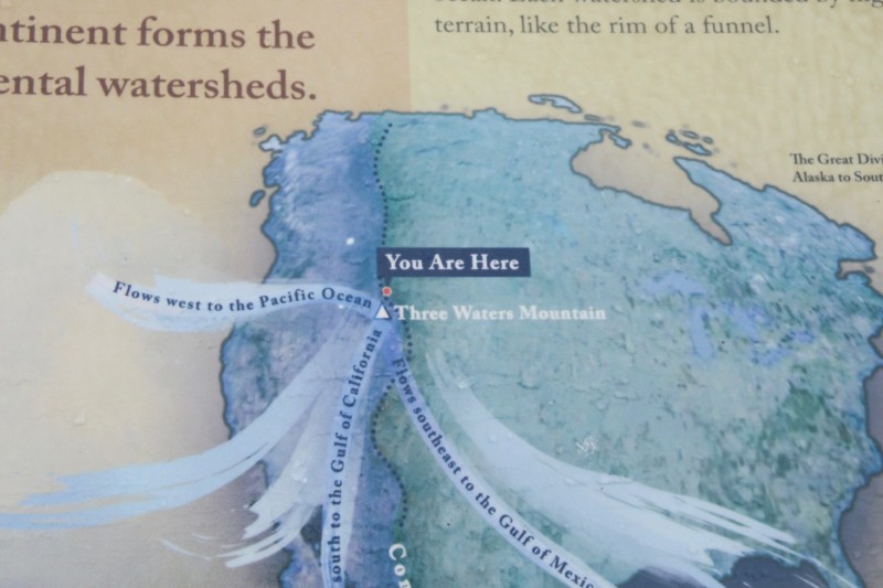
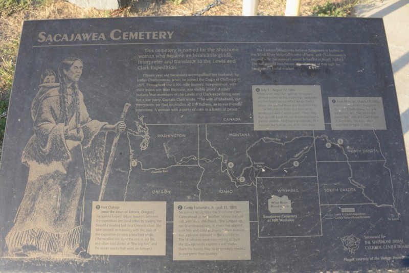
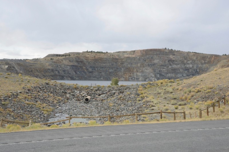
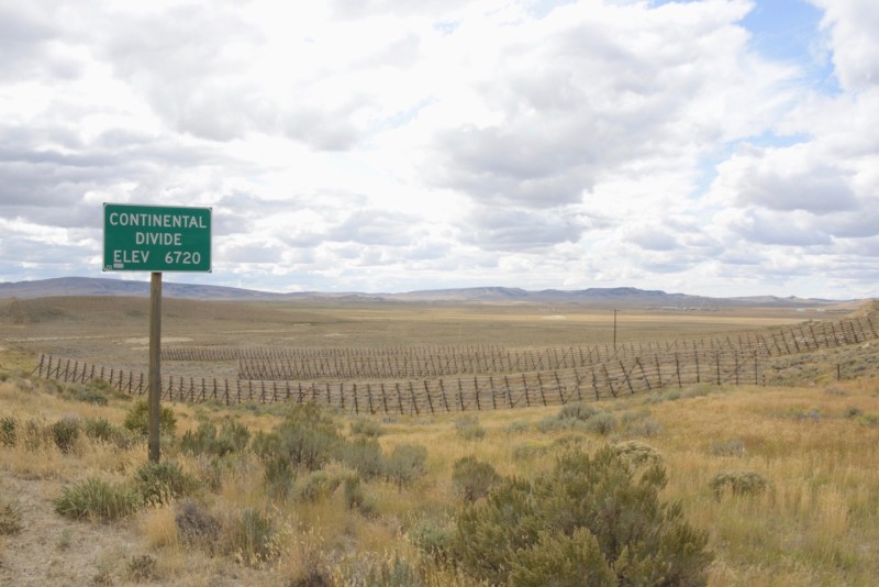
The east end overflows into a drainage ditch along the road, heading east, then drains into DeLacy Creek, which drains into the Lewis River, which drains into the Snake River, which drains into the Columbia River, and into Pacific Ocean, at Astoria, Oregon.
Continental Divide
The wayside display next to Isa Lake explains some of this.
Continental Divide
Continental Divide
Continental Divide
Continental Divide
Continental Divide
Isa Lake was targeted as an attraction by Hiram Chittenden, the Army Corps engineer who planned much of the 140-mile Grand Loop Road connecting the attractions in Yellowstone Park.
Continental Divide
The status of Isa Lake as a natural lake is challenged by the substantial road engineering that has altered its form and its drainage behavior. Apparently, too, the hydrology of the area has changed so that the lake doesn’t fill up with enough water to drain in either direction.
Continental Divide
Five miles away, the Grand Loop Road crosses the Continental Divide again.
Continental Divide
Seven miles further down the road, south of West Thumb, the road crosses the Divide again, for the last time in the park.
Continental Divide
Despite Yellowstone’s two million visitors a year, on 310 miles of roads and in nearly 2,000 buildings, the southeastern side of Yellowstone Park is remote. A few miles east of where the Continental Divide leaves the park is an area that is 21.7 miles from a road of any kind, considered to be the most remote place in the lower 48 states, by some ways of measuring.
Continental Divide
The region also has a remote site known as the Parting of the Waters, where Two Ocean Creek emerges from the mountains and drains into both the Atlantic and Pacific (through Atlantic Creek and Pacific Creek), thus dividing the Divide.
Continental Divide
The Continental Divide is next crossed again by a highway at Togwotee Pass, 20 miles south of Yellowstone Park, and 20 miles east from the entrance of Grand Teton National Park.
Continental Divide
The road, US Highway 26, is the second highest paved crossing of the Divide in Wyoming, 9,658 feet above sea level.
Continental Divide
South of Togwotee Pass is Three Waters Mountain. Waters flow down its sides into streams that flow, eventually, into three major rivers: the Columbia River and Colorado River, on the Pacific side, and the Missouri/Mississippi River on the Atlantic side.
Continental Divide
Continental Divide
Togwotee Pass also offers splendid views of Grand Teton and the rest of the iconic Teton Range, on a clear day.
Continental Divide
The Divide travels through the crest of the Wind River Range, which has a few trails and small dirt roads through it, but is otherwise a mountainous barrier for 130 miles between paved roads.
Continental Divide
The east side of the range is mostly the Wind River Indian Reservation, a sovereign nation of the Eastern Shoshone, established in 1868, and covering 3,400 square miles, about the same size as Yellowstone National Park.
Continental Divide
Sacajawea, the famed Shoshone Indian so helpful to Lewis and Clark, has a memorial in the cemetery at Fort Washakie, on the reservation.
Continental Divide
She was born near the region of today’s Salmon, Idaho, through which she guided the Corps of Discovery, after they crossed the Divide together at Lemhi Pass in 1805.
Continental Divide
The Sacajawea Center, located in Salmon, Idaho, commemorates her life in that region.
Continental Divide
Some believe she died in her twenties, in 1812, at a fur trading post in what is now North Dakota, near Lake Sakakawea, a massive reservoir on the Missouri River built in the early 1950s, that bears her name (and which flooded several settlements, native and otherwise).
Continental Divide
Others claim she married into the Comanche Tribe, and lived into her 70’s, mostly in Wyoming, until 1884. Some interpretive plaques at the memorial claim that she is buried here.
Continental Divide
Others say elsewhere.
Continental Divide
Either way, wherever her body is, her spirit, and the American myths her legacy embodies, reside in the mountains of the Continental Divide.
Continental Divide
The Wind River Range, after 53 mountain peaks over 13,000 feet high, peters out at its southern end at South Pass, a historic throughway over the Continental Divide.
Continental Divide
The historic South Pass is on a dirt road a couple miles south from where Highway 28 crosses the Divide, scattered with a few interpretive plaques and monuments, but rarely visited.
Continental Divide
This was where the California Trail, the Mormon Trail, the Oregon Trail, and the Pony Express Trail converged.
Continental Divide
A roadside rest is provided for today’s travelers.
Continental Divide
Gold mining developed in the region in the 1860s, and continued sporadically through the 1930s. The Carissa Mine and Mill was the largest of the mining facilities in the region. It closed for the last time in 1949, and in 2003 it was acquired by the State of Wyoming to be preserved as an historic site.
Continental Divide
The mill is located in a gulch along Willow Creek, in South Pass City, one of two towns left from the gold mining period.
Continental Divide
South Pass City had a peak population of as many as 3,000 people in the late 1860s, when it was likely the second largest city in Wyoming. It is now the state’s largest historic site.
Continental Divide
The town has a handful of private homes and around a dozen residents, in addition to the preserved structures owned by the state of Wyoming.
Continental Divide
Atlantic City, a few miles away in the gulch along Rock Creek, is less preserved, but more active.
Continental Divide
The local population of around 100 people live creatively amidst the remains of the old mining town, operating a few bars and B&Bs for tourists.
Continental Divide
Like many scrappy former mining towns in the west, it is a spirited place.
Continental Divide
Atlantic City had another boom when US Steel opened a modern iron mine nearby in 1962, which operated until 1983, employing as many as 500 people.
Continental Divide
Over those 20 years, US Steel shipped concentrated iron ore by rail to the Geneva Steel Mill south of Salt Lake City, more than 200 miles away. An open pit is now filled with water, next to the highway, as well as sprawling waste piles and a re-contoured landscape.
Continental Divide
The old US Steel headquarters building, clad in steel, and falling apart, still remains.
Continental Divide
Getting the ore to Utah required building 80 miles of new track to connect the mine to existing rails at Rock Springs. The US Steel railway, built in 1962, went through historic South Pass, and was the last railway to be built over the Continental Divide.
Continental Divide
The railway tracks were removed after the mine closed in 1983, though the roadbed remains, next to the old immigrant trail.
Continental Divide
The Continental Divide separates after South Pass, circling the Great Divide Basin, where drainage goes inward and evaporates, instead of flowing to the ocean. 80 miles wide, it is second only to the Great Basin, which covers much of Utah and Nevada.
Continental Divide
Though nearly empty of population, Great Divide Basin is an area of oil and gas extraction, with a little uranium mining, and ranching. Snow fencing helps prevent wind driven snow from piling up on the highways.
Continental Divide
Hundreds of gas and oil wells operate in the Basin, including some directly on the Divide, like this one.
Continental Divide
The Bridger Coal Company operates a large strip mine along the Divide’s southwestern edge, as well as an underground mine.
Continental Divide
Both supply the Jim Bridger Power Plant, less than five miles from the Divide, and one of the largest coal-fired power plants in the nation.
Continental Divide
Not far from the Jim Bridger Power Plant, Interstate 80 crosses the southern edge of the Great Divide Basin.
Continental Divide
Interstate 80 crosses the Divide again 50 miles east.
Continental Divide
The Union Pacific Railway crosses the Divide here, too, twice (into and out of the Basin), next to the Interstate. This is the path that the first transcontinental railway took westward, to meet its eastbound counterpart at Promontory, Utah in 1869, 250 miles west of here.
Continental Divide
The only other active mainline tracks crossing the Divide between here and the Canadian border is the BNSF line at Marias Pass, next to Glacier National Park in Montana. And south of here are just three more mainline tracks crossing the Divide before the Mexican border.
Continental Divide
Interstate 80 is the most direct route between New York and San Francisco, and alongside the tracks and the Interstate over the Divide are important utility corridors, connecting east and west.
Continental Divide
These include fiber optic communication lines, now operated by the Level 3 Company.
Continental Divide
And natural gas lines run by the Enterprise Products Company.
Continental Divide
As well as microwave relays, still used for communications by some companies, like the railway.
Continental Divide
South of Rawlins, the split in the Continental Divide around the Great Divide Basin unites into a single line heading southeast towards Colorado. The Divide enters the Sierra Madre Range near Bridger Pass, once part of the Overland Trail until the nearby transcontinental railway made it obsolete in 1869.
Continental Divide
Highway 70, known as the Battle Highway, is the only paved road through the Sierra Madre Range. It connects the town of Baggs to Encampment, 50 miles away, and goes through Battle Pass along the way, at the crest of the Continental Divide.
Continental Divide
Though it is a remote region, and not on its way anywhere for most people, interpretive signage is heavy along the road, mostly credited to the Medicine Bow National Forest.
Continental Divide
One sign explains the tie hacks who lived in these mountains in the 1880s to the 1920s, felling trees that would be floated downstream in the spring to Union Pacific’s transcontinental railway, for use as railroad ties across the otherwise treeless plains of Wyoming.
Continental Divide
Another sign is about Jim Bridger, the famed mountain man and guide, who traveled through these parts in the 1820s and 1830s, and whose name appears throughout the region, including Bridger Pass, Bridger Mountains, Fort Bridger and the Bridger Power Plant.
Continental Divide
An interpretive sign overlooking Battle Mountain suggests that another common name around here, Battle (Battle Highway, Battle Mountain, Battle Pass, town of Battle), comes from Indian battles fought in the region.
Continental Divide
At yet another turnout on the road is a monument, erected by the Historical Landmark Commission of Wyoming in 1949, that claims Thomas Edison got his idea for light bulbs while thinking about the filaments in his bamboo fishing pole on a camping trip here in 1878.
Continental Divide
Approaching the Divide from the west is a sign discussing the Rudefeha Mine, which was the largest of the copper mines in the area. Though it operated for just ten years, between 1898 and 1908, it had a profound impact on the region.
Continental Divide
The mine site is otherwise invisible, a few miles into the forest, and inaccessible, on private property that is gated and posted.
Continental Divide
Another sign explains how the Ferris-Haggarty Tramway carried ore from the mine to the smelter in Riverside, 16 miles away, over the top of the Continental Divide, on what was the longest aerial tramway in the world, at the time.
Continental Divide
Trees thin out at the top of Battle Pass, offering views down both sides of the Continental Divide.
Continental Divide
At nearly 10,000 feet, this is the highest major pass over the Divide in Wyoming, and the southernmost pass in the state, just a few miles from Colorado.
Continental Divide
A few bits of the town of Battle remain at the top of the pass. Battle was one of several settlements in and around the mines, with a population of a few hundred people around 1900, and had a post office, store, school, two hotels, a notorious saloon called The Office, and even a newspaper to cover all the action.
Continental Divide
It is downhill from here to the town of Encampment, on the eastern side of the Divide.
Continental Divide
The largest attraction in this small community of 450 people is the Grand Encampment Museum and Interpretive Center.
Continental Divide
With all its reconstructed and relocated buildings, it's said to be the second largest museum in Wyoming, after the State Museum in Cheyenne.
Continental Divide
Among the displays is a reproduction of part of the aerial tram that once carried ore 16 miles over the Divide to the smelter in town. There were 370 of these towers supporting the looped cable that held 840 buckets, each capable of carrying 700 pounds of ore.
Continental Divide
It operated for less than five years before the mine went out of business and closed.
Continental Divide
The tram was among the first major projects of the Riblet Tramway Company of Spokane. Riblet would go on to become one of the largest chairlift companies in the nation, helping some old western mining towns find new life as ski resorts. Some trams now lift people to the top of the Continental Divide.
CLUI logo