Most Initial Points are created incidentally, as baselines (and sometimes the meridians) are usually created first, with one end anchored on relatively immutable geographic features, such as the confluence of rivers, or latitudinal lines. The west has a number of exceptions, where prominent peaks were selected to be Initial Points, and then base-lines and meridians were drawn from them, as their visibility from great distances aided the surveyor’s task. Such was the case with Mount Diablo, an isolated mound rising above the surrounding valley, east of the San Francisco Bay area. In 1851 it was selected to be the Initial Point for the federal land surveys for northern California and Nevada.
 Mount Diablo has the most elaborate commemorative architectures of all the Initial Points. The building at the top of the mountain, built by the Civilian Conservation Corps in the 1930s, contains a small museum and encloses a monument built on top of the summit. The building itself extends the peak another 45 feet in elevation.
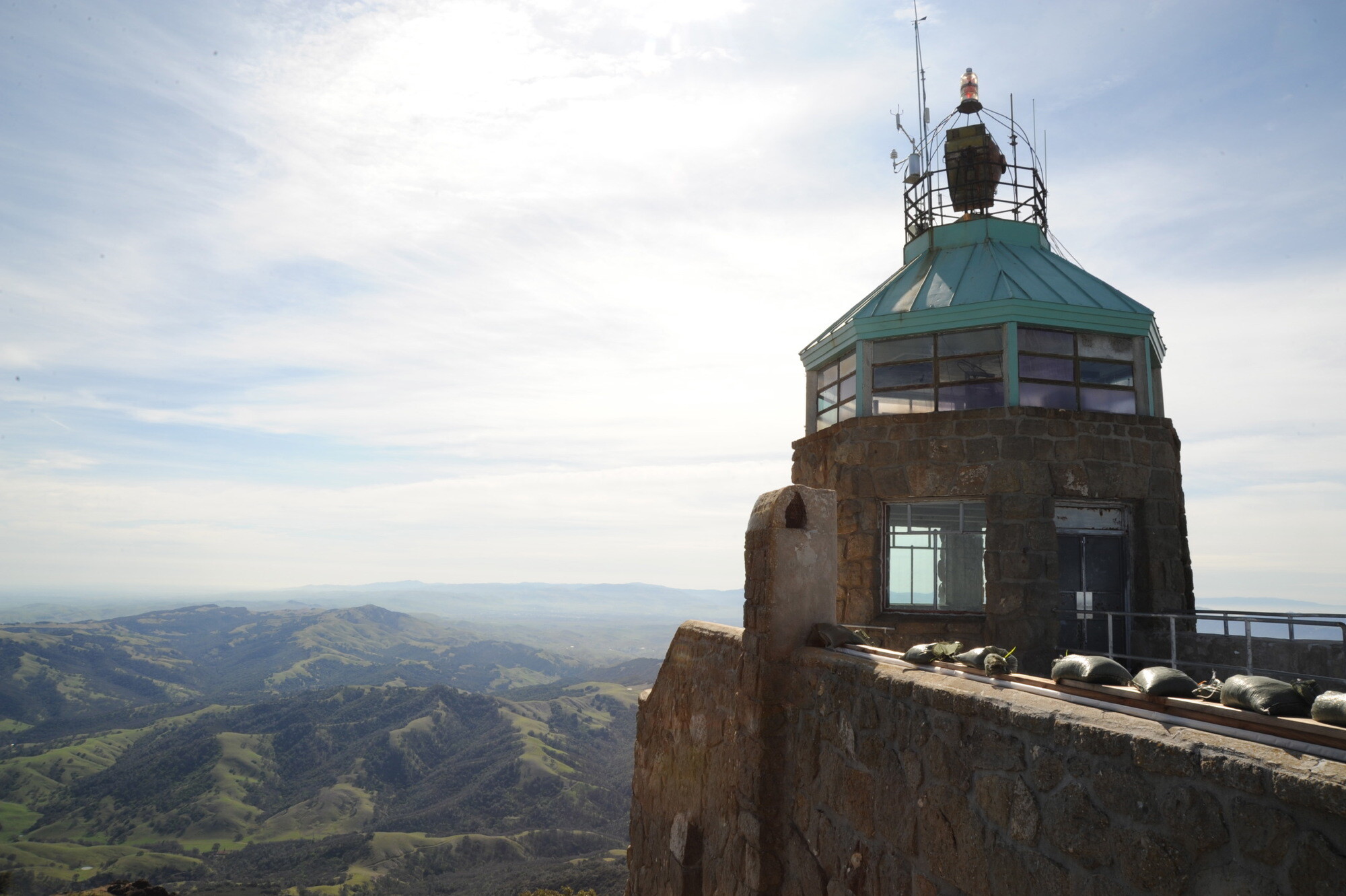 The view from Mount Diablo covers more land and water than can be seen from any U.S. park in the lower 48 states, they say.
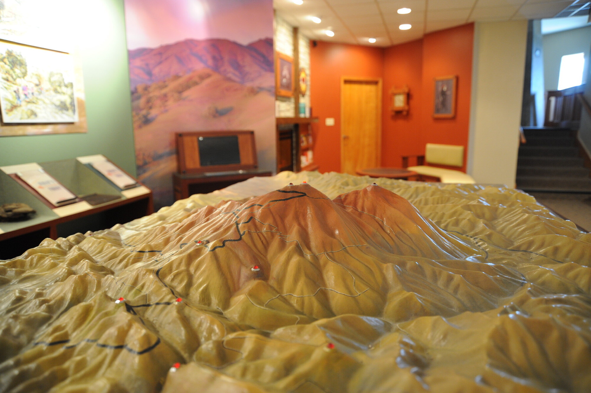 Interpretive displays inside the museum include a miniature Mount Diablo.
 A concrete column, built at the same time as the rest of the structure, sits atop the exposed bedrock of the summit and continues through the ceiling . . .
 . . . to a viewing gallery on the level above . . .
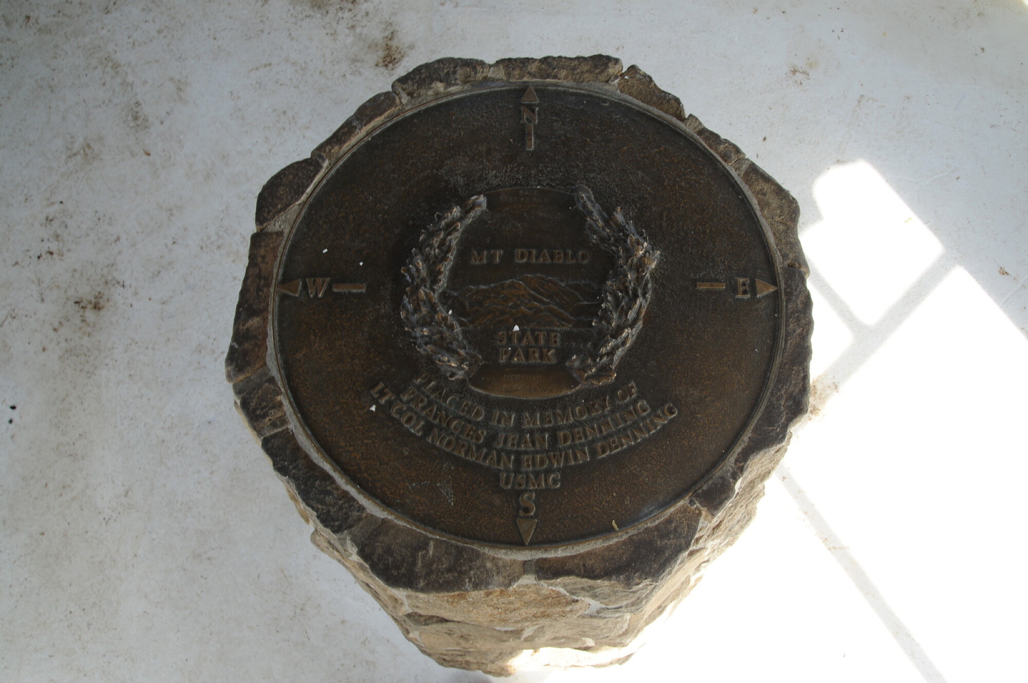 . . . where it is topped with a brass plate.
 The rock of the actual summit is exposed at the base of the concrete column.
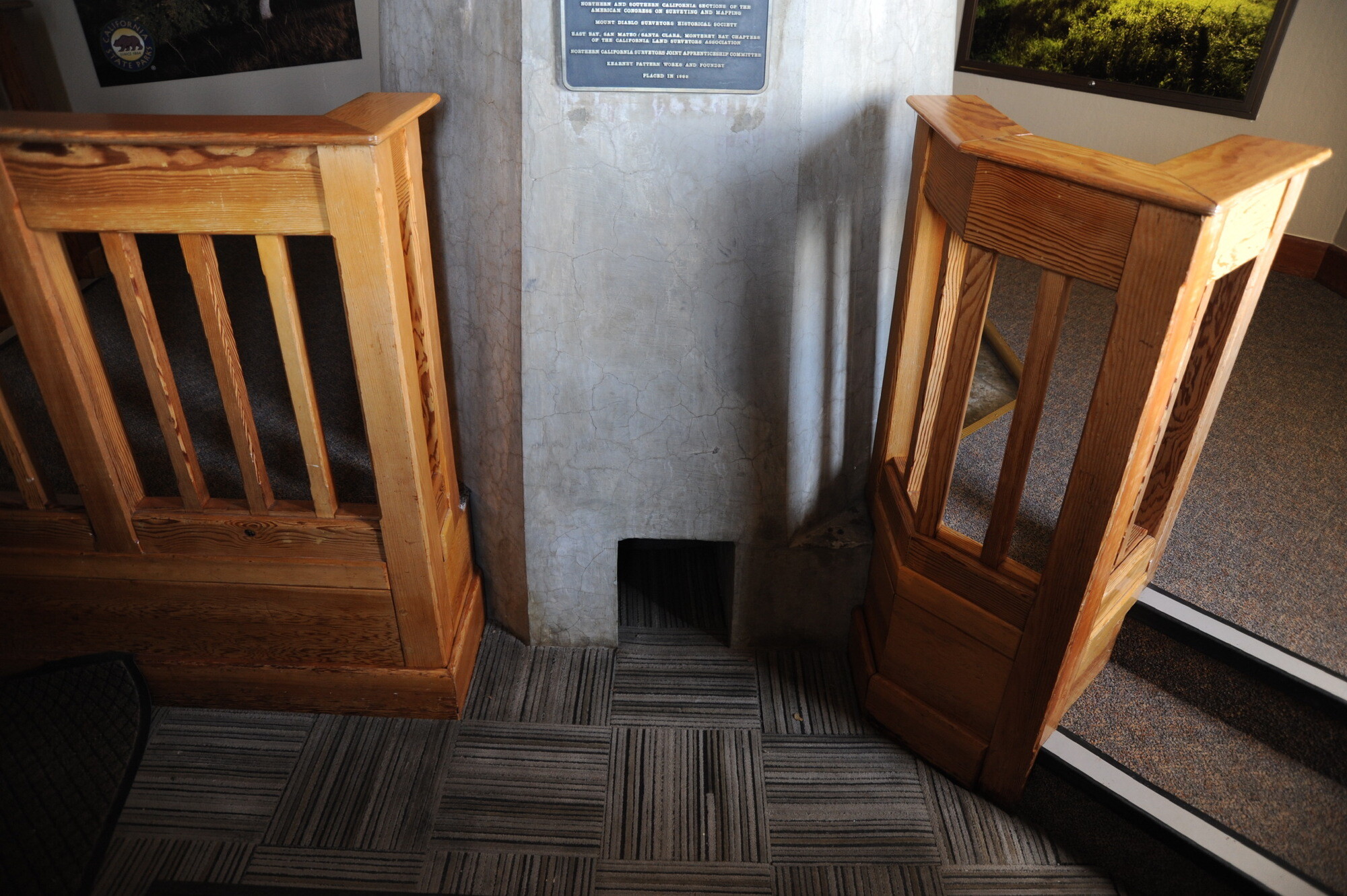 An opening at the base of the column was provided to allow access to the exact spot from which the survey was conducted, marked now by a copper bolt head left from a 1876 triangulation station.
 Later research in the 1980s suggested that the copper bolt head, left exposed inside the center of the column, was actually from a coast and waterways survey started in 1852, and that the 1851 public lands survey mark, a small rectangular depression in the rock summit, is actually three feet northeast from the center of the pillar, a point that is now under the floor of the museum. If this is true, then the column, and the axis of the entire building, is off by 36 inches.
 The survey lines from Mount Diablo extend from the Pacific Ocean to Utah, and from Monterey Bay to Oregon, covering an area that includes most of California and all of Nevada (in green).